
Today we woke up to beautiful sunny weather with relatively clear skies. This was the first day we had no rain! It is still darn cold, though. Maybe 10 degrees and a lot colder when its windy (which is all the time).
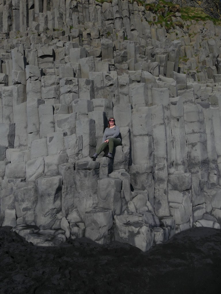
Reynisfjara black sand beach is at the edge of the town of Vik. Four (?) 15m basalt sea stacks called Reynisdrangar make up the southernmost point of the mainland of Iceland (there are some islands further to the south).
Legend says the stacks originated when two trolls tried to drag a three-masted ship to land. They were ultimately unsuccessful and became petrified when they couldn’t hide from the sun in the morning.
Today we have viewed them in the morning from the east, from the top and from the west in the afternoon.


This beach is said to be the wettest place in Iceland with 340 days of rain per year. Apparently we got really lucky today! The sun was out and we took full advantage.
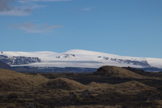
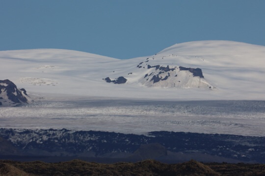
From Vik we headed east again. Due to the clear weather, we saw all kinds of amazing mountain views that were not visible on our previous eastern drive.
Myrdalsjokull ice cap was in view and begging for a photo. We did acquiesce to that request.
The ice cap lies over the huge magma chamber of the Katla volcano. She was named for a legendary housekeeper at the local monastery who was thought to be a witch. When she killed a shepherd for stealing her most precious possession, she ran away to the glacier and was never seen again.

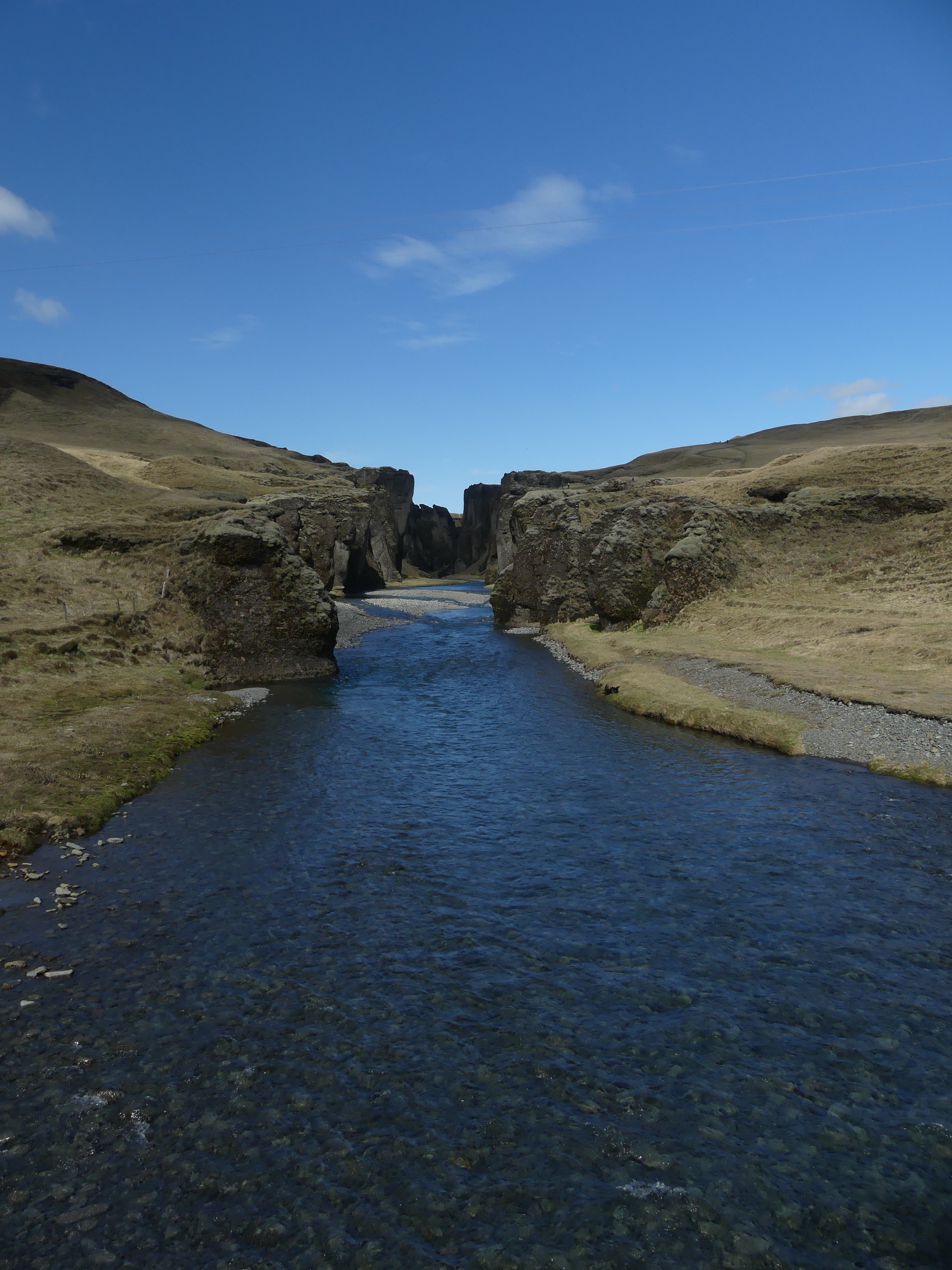
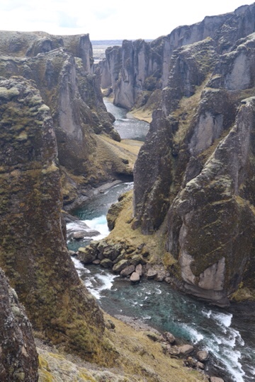
Fjadrargljufur Canyon is called a ‘ripple’ in the earth. There are multiple viewpoints along the trail.


We had a picnic lunch at the parking lot and headed back west to Vik.
The huge promontory above the town of Vik has a gravel road that is supposedly drivable to the top. Unfortunately a few hundred feet up the road was blocked with an ‘impassable’ sign.
So we hiked it instead. 268 vertical meters UP and 6.84km round trip. Sorry, Mom, there were some cliff-sides involved. But the views were worth it. We figure we could have driven the Jeep easily if the road had been open.


And finally, we came back around to view Reynisfjara from the west. The black sand beach was ranked as one of the 10 most beautiful non-tropical beaches in the world in 1991 and the 6th best beach in the world in 2021. It is very nice, but we’re not sure who makes these rankings…


The Halsanefshellir Cave is carved in the basalt columns lining the beach


With that we were done for the day. Time to head back to the lodge for dinner.
El Taco in el bowl-o for those of you who ever ate at Red Robin in the 90’s.


Leave a Reply